
EOLIAN PROCESSES AND LANDFORMS
- aeolus: Greek god of the wind
- aeolians: a Greek tribe
- aeolian harp: produces music as air passes over the
strings
- wind is an important geomorphic agent in arid
environments and in other smaller areas where fine
sediments are exposed to wind, i.e. where surface cover
is lacking: beaches, floodplains, deserts, soil disturbed by agriculture
- otherwise wind is not an important geomorphic agent due
to its low density relative to rock: 1/2000 as opposed to
1/1.6 for water/rock
- given the buoyant force of water, little energy is
required to keep sediment suspended, whereas in air only
the finest sediments (dust) remain in suspension
Controls on wind erosion
- wind velocity
- E = V3rho, where E is erosivity , V is
velocity and rho is air density
- thus the erosivity of wind is an exponential
function of wind velocity, i.e. if the
wind velocity doubles, the wind is 8X more
erodible or, if it triples, the wind is 27 times
more erodible
- that is why we observe massive wind erosion
(dust) with a significant increase in wind speed
- surface cover
- an extremely important factor since there is no
wind erosion on a vegetated surface
- wind velocity decreases exponentially near the
ground and is theoretically zero on a natural
(i.e. rough) surface; thus erosivity (V3
is dramatically reduced)
- on a windy day, put your nose next to the ground
and you will discover there is no wind; small
birds and insects take advantage of this on windy
days
- the zone of little or no wind is called the
laminar sublayer (or the boundary layer), the
rougher the surface (e.g. taller the vegetation)
the deeper the layer of laminar air flow (i.e. no
turbulence to entrain and suspend sediment)
- thus there is no wind in the interior of a closed
forest
- grain size
- threshold erosional velocity is related to the
square root of particle size
- thus when the threshold velocities for various
particle size plot as a straight line when the
particle size axis is on a square root scale
- the threshold velocities are slightly lower for
sand when impact among grains (saltation and
creep) is taken into account
- the fluid threshold velocities (wind shear) plot
as two straight lines that slope down to converge
at a minimum threshold velocity for coarse silt
and fine sand (i.e. these are the most easily
eroded grains)
- with smaller particle sizes grains tend to cohere
when wet and resist erosion
- larger grains resist erosion by virtue of their
greater size (mass)
Erosional processes and landforms
- deflation: entrainment of loose sediment
- deflation hollow (blowout)
- shallow depression produced by deflation
- often originates from the destruction of
vegetation (e.g. fire, recreational use of dunes)
- depth is limited by lag gravel or the water
table, since wet sands resists deflation and
favours the establishment of plants
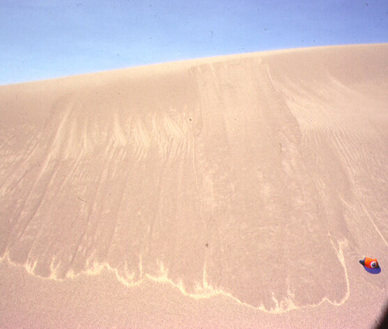
- abrasion (sand blasting)
- impact of entrained sand grains against rock
surfaces and other grains
- yardangs
- wind abraded ridges oriented with the
prevailing winds and separated by abraded
chutes that conduct windblown sand
- ventifacts
- stones faceted (planed) by abrasion
- with changing direction of dominant
winds, different facets merge along sharp
ridges to transform rounded stones to
angular ventifacts
Eolian sediment transport
- suspension
- air suspends particles less than 0.2 mm in
diameter
- this dust is carried 1000s m upward and 1000 kms
downwind, held in suspension by turbulent eddies
- saltation
- transport of sand grains in long (1 m or more)
low (within 1-2 m of the ground) trajectories as
momentum is passed from grain to grain
- grains are momentarily suspended but too heavy to
remain in suspension
- most of the transport of dune sand
- at high wind speeds saltation is more or less
continuous and appears as a fuzzy layer next to
the ground
- creep (traction)
- movement of coarse sand and pebbles (up to 6x
larger than saltating grains) as they slide and
roll impacting one another and transferring
momentum
- usually does not occur with velocities less than
4.5 m/sec
note similarities and differences with transport by running
water
- larger grains are suspended in water than in air
- saltation accounts for most sand transport in air, but is
much less common in water because sand grains tend to
remain in suspension in turbulent water
- larger particles (gravel) move as bedload (traction) in
water
- air has no dissolved load
sorting
- the finest fraction is removed from the eolian landscape
as dust and accumulates elsewhere as loess
- saltating grains out distance the traction load, leaving
a lag of creeping and non-transported grains
- with exponential increase in sand transport with wind
velocity, energy is quickly diverted from erosion to
transport dissipating much of the wind energy
- thus wind velocity increases over barren rock surfaces,
where sediment transport and the friction among saltating
grains and with the stationary sand is not a factor
- sand is transported until friction over a rough surface
(sand or vegetation) or an obstruction causes a decrease
in wind velocity and deposition
- therefore eolian landscapes are characterized by a mosaic
of 1) windswept and sandblasted surfaces, 2) stony lag
deposits, 3) sand sheets or dune fields, and 4) loess
sheets
- unlike other geomorphic processes wind does not result in
the lowering of the landscape (denudation) towards an
ultimate base level, rather sediment is usually just
moved within a closed system in the direction of
prevailing winds, unless it gets exported (e.g.
transferred into a river)
Depositional landforms
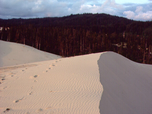
- ripples
- small sand waves with a wavelength of about 1 m,
i.e. the typical path length of saltating grains
- they are ephemeral and mobile, i.e. move,
disappear and reform during wind storms
- common the windward slopes of sand dunes
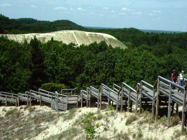
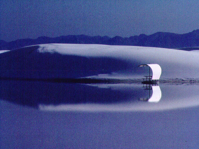
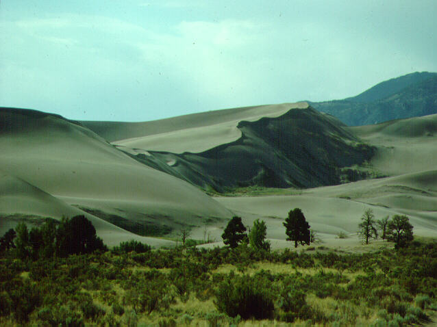
- dunes
- classic eolian landform
- stable or advancing landform
of windblown sand
- originates as a mound of free sand from a sandy
surficial deposit (e.g. beach, weathering
sandstone) or from a blowout
- as the mound grows it develops the dune asymmetry characterized
by a gentle windward slope and a leeward slip
face at the angle of repose for sand
- same longitudinal shape as a ripple but several
orders of magnitude difference in size, and thus
dunes are much less mobile and more persistent
- dunes migrate downwind as sand
saltates up the windward face (i.e.
ripples migrate), accumulates where the wind dies
just over the crest, and then flows (mass wasting) over the slip
face
classification of depositional landforms
- barchan dune
- classic desert dune
- crescentic in plan view, horns (cusps) project
downwind and thus the head faces into the wind
and the slip face is concave downwind
- isolated, freely migrate across desert plains
maintaining their form
- parabolic dune
- associated with vegetation, so form in subhumid
and semiarid environments (rather than arid)
where vegetation is nearby (e.g. beaches,
grasslands - sw sask)
- originate as a blowout, dune forms as the head of
the dune at the downwind edge of the blowout
develops the dune asymmetry and advances beyond
the horns
- stability of the sides and horns used to be
attributed to vegetation but recent research
(including P. David and S. Wolfe in Saskatchewan)
suggest that water is a more important factor, so
the stability of parts of a parabolic dune and
the presence of vegetation are both related to
water
- eventually deflation lowers the blowout to the
water table or to an underlying stratum lacking
sand (e.g. bedrock or stony clay till)
and the dune becomes impoverished
- transverse dune
- linear, cuspate and forms perpendicular to the
wind, with large sand supply and low winds
- with stronger winds they evolve into barchans
- usually occur on beaches, floodplain alluvium or
erodible sandy bedrock rather than in dry deserts
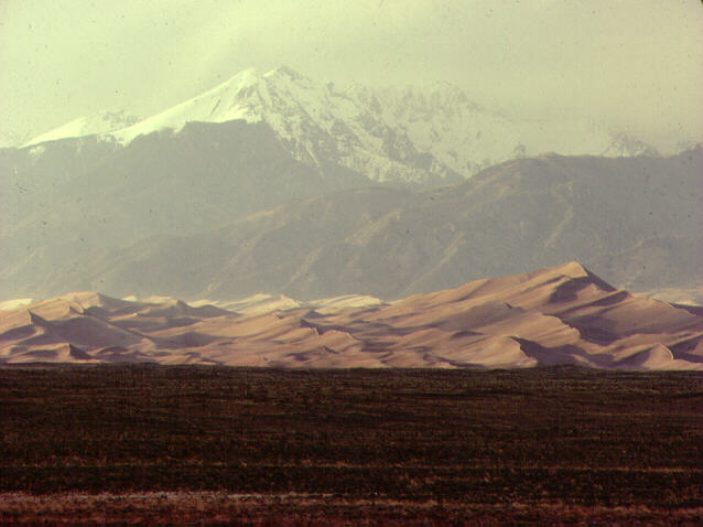
- longitudinal dune
- large (kms in length, ~ one km wide) linear forms
parallel to the strong persistent winds
- form in dry subtropical deserts with irregular
sand supply
- separated by lag gravel
- whaleback: a ridge of coarse sand left in the
path of a migrating longitudinal dune
- erg
- "sand seas", vast sand sheets (Lawrence
of Arabia stuff)
- 1/4 - 1/3 of the area of true deserts
- the largest sandy deserts overlie poorly
consolidated sandy bedrock
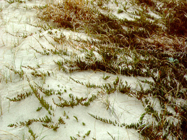
- fixed sand sheets
- undulating sandy hills in subhumid environments (e.g.
large parts of the Great Sand Hills of
Saskatchewan and the Sand Hills of Nebraska)
- deflation hollows interspersed with subdued
stable parabolic dunes
- sand shadow
- accumulation of sand on either side of a fixed
obstacle (e.g. shrub or tuft of grass)
- sand drift
- accumulation of sand in the lee of a gap between
obstacles or in the still air at the bas of an
escarpment
[ Course Outline | Next Topic ]